|
[Home] [Camper Add-Ons] [Campsite Map] [Interviews] [Photo Albums] [Sporadic Blog] [Tips] [My Music] [Contact Me]
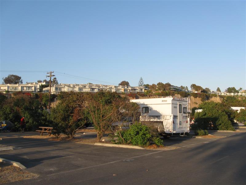
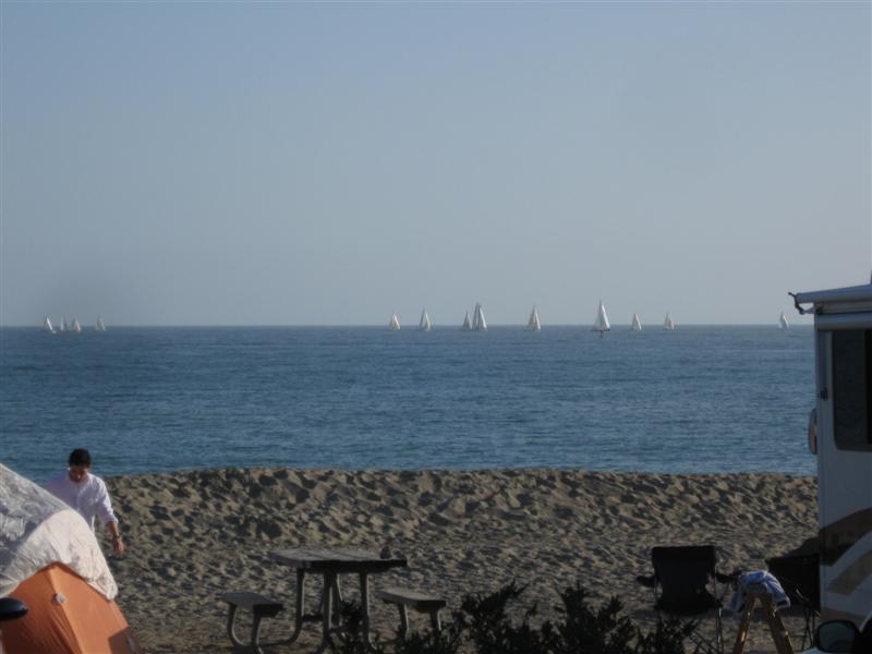
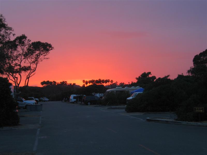
|
- You might get an occasional tweet if you follow me on Twitter @RamblinRalph
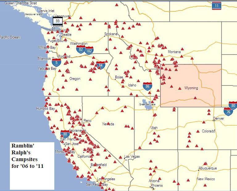
- The "big picture" of where I've camped
- Sign my guest book and leave comments
- One of my photos was a winner in the Truck Camper Magazine 2011 Calendar Photo Contest! See it here.
![]()
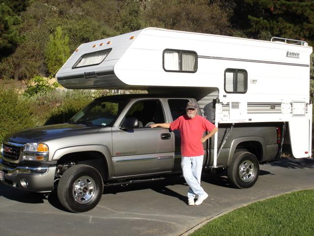
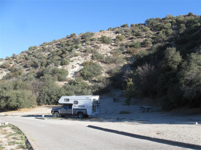
| 2006 GMC 2500HD w/2001 Lance 845 |
Previous years' travels: 2006
2007 2008 2009 |
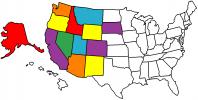
States
Visited Map (plus BC/AB/YT in Canada) |
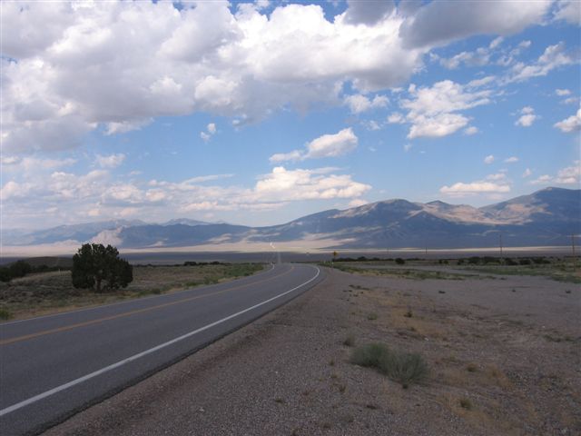
I bought my new truck and used camper in late October of 2005. The following May, I "hit the road" full-time for 6 months. I've done the same every year since, and now 2014 will be my 9th year of ramblin'! My how time flies. Not all of my nights are spent camping, but most are. I don't make entries that are repeats of previous campgrounds or when I stay with my kids or friends. Campsite fees are for one night with no discount (and no hookups, unless specified). However, being the old geezer that I am, I get 50% off at U.S. Guvmint CGs with the valuable Golden Age card, plus free entry to National Parks.. One of the few ways (in addition to retirement) it pays to get older. All the aches and pains sure aren't fun. :)
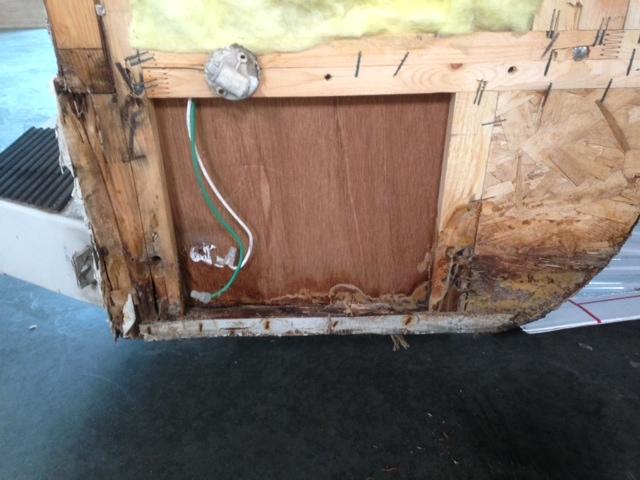
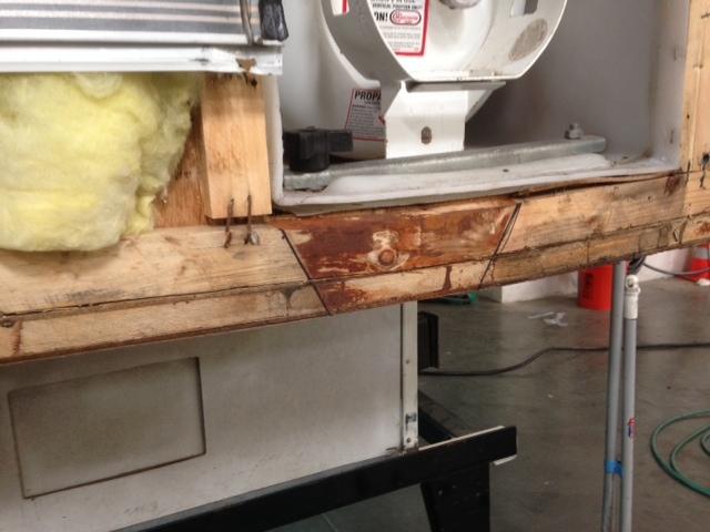
I started my travels this year with around 80K miles on my camper and 120K miles on my truck. I took my camper to the Lance factory this winter and had some structural repairs done to it (pics here and here). It should be in good shape for several more years of travel. Of course, my old body will probably wear out before the camper. :)
Note: Click on small photos for a larger one. Click on
the USA map/flag (![]() )
to see the actual camp location (green arrow) on a map (+/- 50 ft).
)
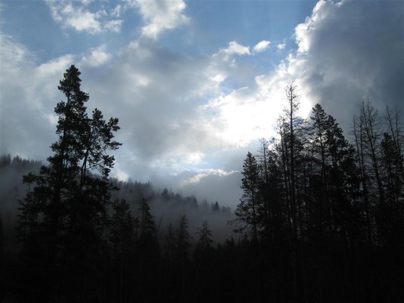
to see the actual camp location (green arrow) on a map (+/- 50 ft).
|
Ref # |
Date |
Location |
Campsite & Other Photos (click links) |
Comments |
|
|
11/3/14
|
That's it folks. Road Trip 2014 is over. I'm back at my winter residence on the Central Coast of California. Had another great year of ramblin'. Thanks for traveling along with me! This year's stats:
You can contact me via my Guest Book or email. The quick way to see where I've been is to look at my Campsite Map (click link or see menu at top of page). Standby for Road Trip 2015 starting in May!! |
|
|
|
90 |
11/2/14 |
Jalama Beach CG (County). 4 mi S of Lompoc, CA on CA 1
then 14 mi SW via 2 lane Jalama Rd (paved, but curvy). 40 ft. Ninety different campsites for the year sets a record for Ramblin' Ralph! :) |
|
Very nice, isolated CG on the beach. 100+ sites (sand and paved) with a few small cabins, too. Even has a small store/cafe with good food (famous for their hamburgers). Surf is the predominate sound you'll hear and an occasional choo-choo. Showers and flush toilets. Was here in 2009. $23. |
|
89 |
11/1/14 |
Wheeler Gorge CG (USFS). About 8 mi N of Ojai, CA
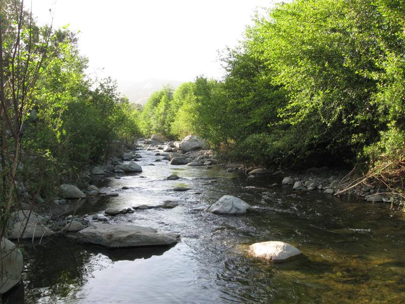
on curvy hwy 33. 1800 ft. |
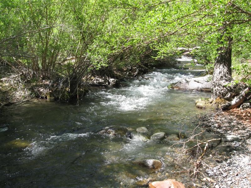
70 paved sites, usually close together. Most well shaded by large live oak trees. In a narrow canyon, so late sunrise and early sunset. CG is alongside hwy, but minimal traffic. Small creek runs though CG. Third time here. $23. |
|
|
88 |
10/19/14 |
Los Alamos CG (USFS), off I5 8 mi S of Gorman,
CA. Take Smokey Bear Rd exit, then S to lake entrance,
then right and follow road N & W about 2 mi. 2800
ft. Note: My Garmin GPS tried to route me another way from Smokey Bear Rd, which was longer and I don't think would have worked. |
93 sites in 3 loops on hilly, sandy land. No or little shade in sites, except for about 6 with shade structures. Flush toilets. Pyramid Lake nearby. Slight hum from I5, but overall very peaceful. Dump station. 3 years ago didn't get the Golden Age discount, but do now (new concessionaire?) $20. Gas Price Rip-Off: On the way here, I pulled off I5 at CA46. Filled up at the 76 station, which was easiest. Afterwards, noted the price was $3.97, which seemed high. Looked across the street and Chevron was the same. However, 3 other stations (Arco, Pilot and ???) at that exit were under $3.30!!! I know it's "buyer beware", but this is a ridiculous! |
|
|
87 |
10/18/14 |
Medeiros State Rec Area CG near Los Banos, CA. 3
mi W of I5/hwy 152 jct off 152. 230 ft. |
Primitive sites with ramadas on level land on edge of reservoir. Some shade, depending on site. On O'Neill Forebay near San Luis Reservoir. Lots of birds on the water. Pit and vault toilets 3rd time here. $20. |
|
|
86 |
10/17/14 |
Lodi Grape Festival Grounds. Lodi, CA. 50 ft.
|
Here for the Fall Campout of the California Bluegrass Association. Had fun pickin' & grinnin' with some people I knew. Yeehaw! :) |
|
|
85 |
10/6/14 |
Prosser CG (USFS). From CA89/I80 jct E of Truckee, CA,
go 3+ mi N then turn E at the campground sign.
1+ mi to CG. .5800 ft.
Note: Road to CG from CA89 not on my GPS. |
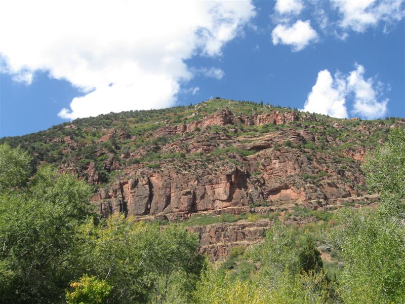
Nice CG with 29 gravel sites, on level land. Thick stand of tall pines provide plenty of shade. Perched above the currently very low Prosser Reservoir. About a mile away is USFS Lakeside CG, which doesn't fit its name right now. $22. |
|
|
84 |
10/5/14 |
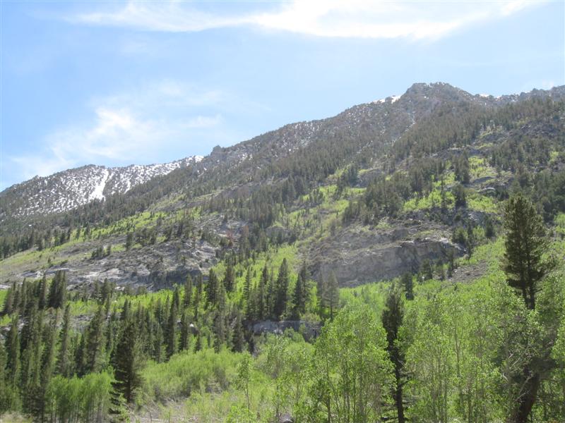
Lower Little Truckee CG (USFS). On CA89, 11 mi
N of I80 jct E of Truckee, CA. 6100 ft.
|
15 gravel sites on level land, between the hwy and the low water Little Truckee River. Scattered pines for "maybe" shade. Golden aspens on the fringe of the CG. . Hwy is fairly busy, so not much peace and quiet during the day. Similarly located CG about a mile N on the hwy. Low of 26F! $20. Before coming here I visited the Emigrant Trail Museum at the Donner Memorial State Park, in Truckee. Watched the movie regarding the ill-fated Donner party. Lesson learned from it: Don't take the cut-off! |
|
|
83 |
10/3/14- |
Alpine Meadows CG in Martis Creek Lake NRA (COE). From
I80 near Truckee, CA, take North Shore Blvd S about
3 mi then 2 mi E on Martis Creek Rd. 5800 ft.
My first CG in California since 6/27/14! |
Nice CG with 25 paved sites on level land. Groups of tall pines provide varying shade to sites. Beautiful view of large meadow from back of CG. Very peaceful at night. Dirt road from CG leads to small, narrow lake with good fishing reputation (catch & release only). Down to 29F at night. Was here last year, also. $18.
|
|
|
82 |
10/2/14 |
Davis Creek Park CG (County). 11 mi N of Carson City, NV
off US395. 5000 ft. |
Very nice CG in tall pines. Plenty of shade. 63 paved sites, on a hillside, with several "arc" pull-thru sites. Looks down on hwy 395 and Washoe Lake. Hwy produces a bit of "hum" noise, but hardly noticeable inside camper. Due to sloping ground, RVs might need leveling blocks. Flush toilets and showers. Was here in 2007. $20 |
|
|
81 |
9/30/14- |
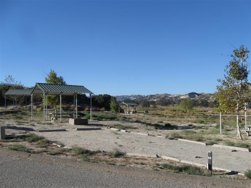
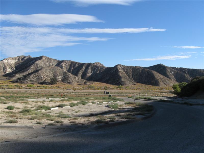
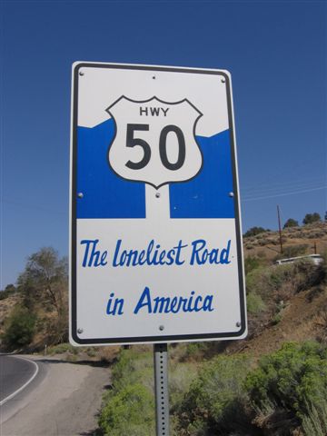
Bob Scott CG (USFS) 6 mi SE of Austin, NV on hwy 50 ("The
Loneliest Road in America"). 7100 ft. |
10 paved sites on sloping land. Many not level, though. Lots of small trees, including pinyon pines. Tried my first pine nut. Not bad.. Very convenient to US50 travelers, but also results in some primarily daytime noise. Not really that busy of a hwy, though. Flush toilet. Down to 26F at night!! Third time here. $10. Stayed 2 nights because I had a stomach bug that kept me up a lot on first night. Needed a recovery day w/o driving. |
|
|
80 |
9/29/14 |
Ward Mountain (USFS). 7 mi SW of Ely, NV on hwy 6. 7300
ft. |
|
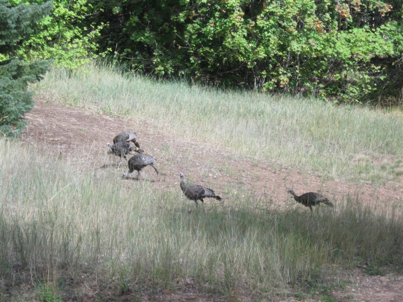
Very nice CG. Looks like it was recently refurbed, since tables, etc. look like new. 30 gravel sites on level ground in 2 widely separated loops. Two group areas, also. Plenty of pinyon pines and junipers. Some slight hwy noise, but not bad. Would be less in Loop B, farther from the hwy. Third time here. Down to 30F at night! $8 Before leaving Ely, stopped by the train museum. Unfortunately it was closed on Tuesdays. Did walk around the train yard a bit (see pics). |
|
79 |
9/28/14 |
Lower Lehman Creek CG in Great Basin National Park. 67 mi SE of
Ely, NV on hwy 50, hwy 487 and park road. 7300 ft. |
|
11 paved sites on definitely sloping land. RVers will likely need leveling blocks. A mix of trees, including aspens (no color yet, though). Very nice creek alongside CG. CG sites and interior road newly paved. 3 other CGs in Park. $5 dump station. Was at Upper Lehman CG in 2009. Price still $12. Low of 32F at night. Brrrr. Didn't take scenic road up to the top or the cave tour. Been there, done that. |
|
|
9/26/14- |
Same CG as 9/5/14 (Maple Grove). |
Was here about 3 weeks ago, on the way to Flagstaff and in the same site. Since then, the maple leaves are just starting to turn fall colors. Rained quite a bit while I was here. I spent most of Saturday inside my cozy and dry camper listening to music, pickin' on my geetar and reading. Oh yes, an afternoon snooze, too. :) |
|
|
78 |
9/24/14- |
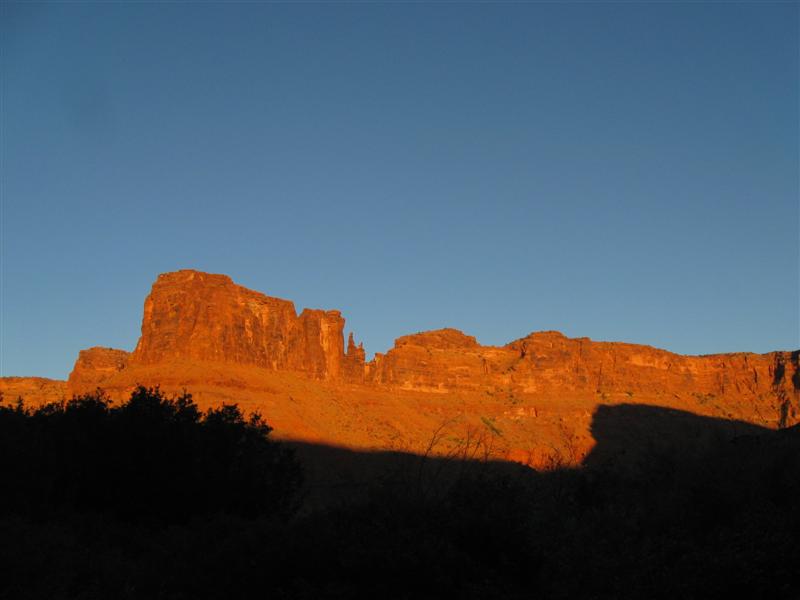
Horsethief CG (BLM). From Moab, UT go 11 mi
NW on US191, then about 12 mi SW on Hwy 313. Watch
for CG sign on right and go 1/2 mi on good dirt road.
5800 ft. |
|
Nice CG with about 60 gravel sites on level land, in a desert environment. Bring your own shade. Lots of junipers around, but not tall enough for shade. Very peaceful at night. Vault toilets. No water, but does have trash bin. Only about 8 mi S to Canyonlands NP. $15. Visited the north section of Canyonlands NP. Liked it the most over the south section and Arches (YMMV). You look out over miles and miles of the Colorado and Green River canyons. |
|
77 |
9/23/14 |
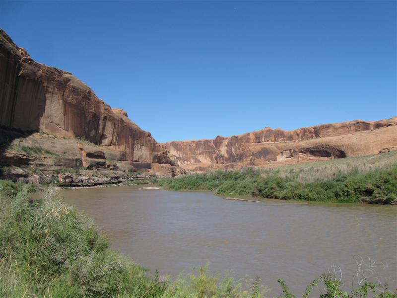
Upper Big Bend (BLM). 8 mi NE on Hwy 128 from
US191/Hwy128 jct N of Moab,UT. 4100 ft. |
|
8 dirt/gravel sites, on level ground, along the Colorado River. In a canyon with red rock bluffs surrounding it. Sites are close together, but have bushes between them for some privacy. Early/late shade from the canyon walls. Never seen this type of toilet before. A pit toilet that is kind of "fenced in" w/o a roof or solid walls. You hang a chain across the entry when you go in!. Busy hwy alongside CG. $15. After "domestic duties" in Moab, I waited too late to find a campsite. Usually do it around 4 to 5 p.m. Didn't start up the canyon until around 6 p.m. and here at the 7th (and last) CG I got the last spot! Whew! After I left the CG, I visited Arches National Park. Was somewhat disappointed. You can't really see the "main attractions" up close w/o walking and it was too hot to do much of that. View area parking lots very crowded, too. |
|
76 |
9/22/14 |
Hamburger Rock (BLM). 5 mi E of Canyonlands
NP (Needles section) on Park Hwy, then about 1 mi N
on dirt road (which is a bit bumpy). Watch for
CG sign. 4800 ft. |
|
Desert environment CG with 8 sites, circling a large rock formation. RVs will probably need leveling blocks. Only shade comes from the rocks early/late in the day. Beautiful views across the desert to rock bluffs. Super peaceful at night. Vault toilet. No water. $6 CG at Canyonlands NP (Needles section) was full. This one is close by on the way out and is a good alternative. Boondocking spots also along the road to the CG. |
|
75 |
9/21/14 |
Dalton Springs CG (USFS). 5 mi W of Monticello,
UT, starting on W 200 S. All paved route. 8400 ft. |
16 gravel/dirt sites on mostly level land. In a thick grove of oaks for plenty of shade. Some aspens also in some CG areas. Most sites are long and include some pull-thrus. Vault toilet. Rained some at night. $10. When I left, I continued W on the mountain road. It's about 13 mi to UT211 and contains 8% grades. No problem going down hill, though. :) Once on UT211 it's another 25 miles to Canyonlands. I stopped at Newspaper Rock, which is loaded with petroglyphs (see pic). |
|
|
74 |
9/20/14 |
Devils Canyon CG (USFS). About 9 mi N of
Blanding, UT on US191. 7100 ft. |
|
42 paved sites in 2 separate areas. Area A (where I am) has 16 sites on level ground, with picnic tables on concrete pads. Area B is on hilly land with picnic tables on the more usual dirt/gravel. Trees are a mix of juniper and pinyon pine. Area B also has some taller ponderosa pine, which provide more shade. Vault toilets. Convenient to US191 travelers, but also means a bit of hwy noise. $10. |
|
73 |
9/19/14 |
Sand Island CG (BLM). 4 mi SW of Bluff, UT
on US191. 4300 ft.
|
|
22 gravel sites, on level land. About 5 sites are near the boat launch, while the rest are in a different area. The muddy San Juan River is alongside the CG, but not visible from most sites.. Most of the trees (cottonwoods) are along the river bank, so don't expect much shade at your site. Vault toilets. Boat launch is popular with river floaters. Bluff with petroglyphs near larger section of CG. $10. On the way here, I stopped at the very scenic Monument Valley. Didn't take the 17 mi tour, but really enjoyed just seeing the sights from the Visitor Center. Base price is $20 for a vehicle with 1 to 4 people, so a bit pricey for a solo rambler. Glad I did it, though. |
|
72 |
9/18/14 |
Sunset View CG (NPS) at Navajo National Monument.
19 mi SW of Kayenta, AZ on US160, then 9 mi N on Hwy
564. 7200 ft.
|
|
31 paved sites, on sloping land. A mix of back-in and side-of-road sites. Most back-in sites are for small rigs (i.e., my size). Your picnic table might not be very close to your site and on bumpy terrain. Lots of small pinyon pines and junipers. Unfortunately, they blocked the nice view into the valley from my site. Dern trees. :) Very quiet at night. Flush toilets. Only about 5 others here. $0. Before leaving I took a 1+ mi r/t hike to view the Betatakin cliff dwelling ruins. Should of brought my binocs. They are way across the canyon. Nice view of the canyon, however. |
|
|
9/17/14 |
Same CG as 9/10/14 (Bonito) |
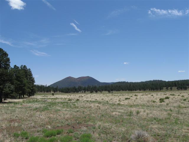
Sunset Crater |
After leaving, I took the 35 mi loop road that goes through Sunset Crater Volcano and Wupatki National Monuments. Had been to Sunset before, but never Wupatki. Wupatki NM has several around 900 year old pueblo ruins. I saw the Wupatki pueblo near the Visitor Center. |
|
71 |
9/15/14- |
Kaibab Lake CG (USFS). From I40/Hwy64 junction
near Williams, AZ, go N about 3/4 mi on hwy 64, then
about 1 mi NW on Kaibab Lake Rd. 6800 ft.
|
Nice CG with 73 paved sites in 2 separate areas, The smaller area is by the lake, while the other is higher up the hill. There is also a group area. Plenty of pines for some shade. Lake very low. Convenient to Grand Canyon, about 55 mi N. Eateries and stores only about 5 mi away in Williams. $20. |
|
|
70 |
9/11/14- |
Fort Tuthill County Park and Fairgrounds. On
US89, 3 mi S of I40/I17 junction in Flagstaff, AZ. 7000 ft.
|
|
Here for the very fun Pickin' In The Pines bluegrass festival. Camped with a jamming buddy from CA and another came for the day. Heard a lot of great music from the stage and did a lot of pickin' and grinnin' with camping neighbors and CA friends. Very nice music stage with fixed seats, folding chairs and grass seating. My first time here and I'd like to come again! |
|
69 |
9/10/14 |
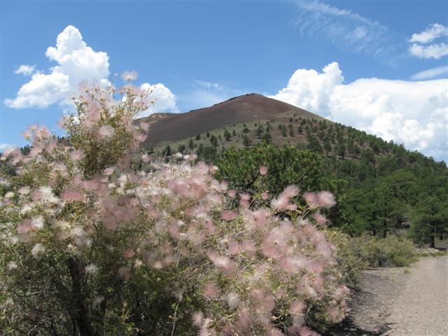
Bonito CG (USFS). 16 mi N of Flagstaff, AZ on hwy 89 and 2 mi
E on NF-545. 7100 ft. |
|
Nice CG with 44 paved sites, well apart. On mostly level land with plenty of tall pine trees for shade. Ground is "volcanic gravel". Flush toilets. Across the road from the Sunset Crater National Monument Visitor Center. Well off the hwy for peace and quiet. $20 |
|
68 |
9/9/14 |
Wahweap CG (NPS) on Lake Powell. About 6 mi NW from
Page, AZ on US89, then 3 mi NE on Wahweap Blvd (follow
CG signs). 3700 ft. |
|
Mega CG with almost 300 gravel sites in 9 loops. Desert environment on slighty sloping land. Bring your own shade. Some small trees, but no shade structures. Pueblo style bathrooms with flush toilets and sinks. Laundry and showers at nearby CG store. All sites have a view of the lake. $26 (A whopping $48 for full hookups!) My first time at Lake Powell. Interesting place. Visited Glen Canyon Dam Visitor Center after leaving. |
|
67 |
9/8/14 |
Kanab RV Corral. On Hwy 89A in downtown Kanab,
UT. 4900 ft. |
|
39 gravel sites, with typical commercial RV park pack-em-in spacing. Nice place, though. Has pool, laundry and showers. In walking distance of stores and restaurants. Biggest downside is that it's right next to busy Hwy 89A. $35 (w/ full hookups). Before reaching Kanab I made a side trip to Bryce Canyon National Park. Was there a few years back, but had forgot how beautiful it was! |
|
66 |
9/7/14 |
Red Canyon CG (USFS). About 14 mi S of
Panguitch, UT on US89, then 4 mi E on US12. 6500 ft. |
|
37 paved sites, well apart, in 2 loops. Enough pines and other trees for moderate shade in most sites. CG is in the very scenic (and aptly named) Red Canyon. Flush toilets. Showers in A loop. Hwy alongside CG is very busy with Bryce Canyon NP traffic, which is only 13 miles East on US12. Don't miss its fantastic scenery! $15. Short thunderstorm (w/hail) after I arrived. Then steady rain for a while. |
|
65 |
9/5/14- |
Maple Grove CG (USFS). From Scipio, UT (on
I15) take US50 about 15 mi S, then W on Maple Grove
Rd (watch for CG sign). Follow paved road about
4 mi to CG. 7200 ft. |
|
Nice CG with about 20 paved sites, plus 3 reservation group areas with multiple sites. A variety of primarily leafy trees, including (who'd a guessed) maples. CG is on sloping land with sites well apart. Fancy red brick vault toilets. Small creek runs through CG. Saw someone who'd caught a couple of small fish from it. CG is at the base of a tall, scenic red rock bluff. Well away from the hwy, so very peaceful here. $15. |
|
64 |
9/4/14 |
Utah Lake State Park CG. About 2 mi W of I15
on Center St. in Provo, UT area. 4600 ft. |
Very nice state park CG. 55 paved sites in 2 loops. Little natural shade, but nice size "gazebos" for each site. No bushes = no privacy, but sites well apart. Boat harbor/launch ramp and day use area. Free-to-campers dump station. Was here in 2010, also. $25 (w/water & elec). |
|
|
63 |
9/3/14 |
Goodenough Creek CG (BLM). About 22 mi S of
Pocatello, ID, on I15 take exit 47. Follow
Merrill Rd W, left on S Marsh Creek Rd, then first right
on Green Rd (look for CG sign on pole). Green Rd (starts
paved, then good dirt) dead ends at CG in about 2-1/2
mi. 5400
ft. Note: Don't use GPS coordinates from uscampgrounds.info, use mine above. That way you'll find it. :) |
|
Primitive, secluded CG with 13 dirt/grass sites,
well apart. Site levelness depends on mother nature
(mine wasn't bad). A variety of trees and bushes.
A narrow dirt road goes through the CG with the sites
on both sides. I didn't go to the end, but a satellite
photo shows a large clearing near the end. Probably
could turn a big rig or trailer around there, but this
CG is best for tenters or small rigs. Absolute quiet
at night, since I was the only one there (yikes, what
was that noise??). BLM says |
|
62 |
9/2/14 |
Stoddard Creek CG (USFS). 12 mi S of MT/ID
line on I15 then 1 mi W on campground road. 6300
ft. |
|
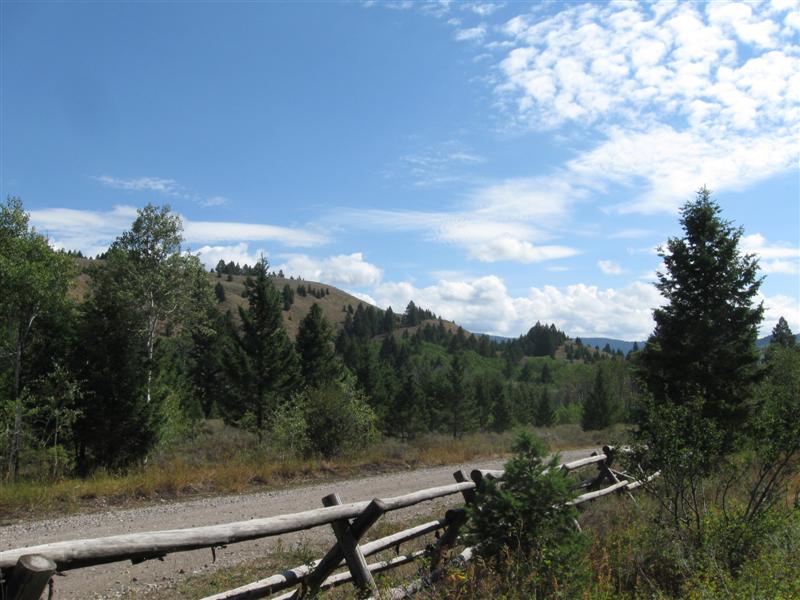
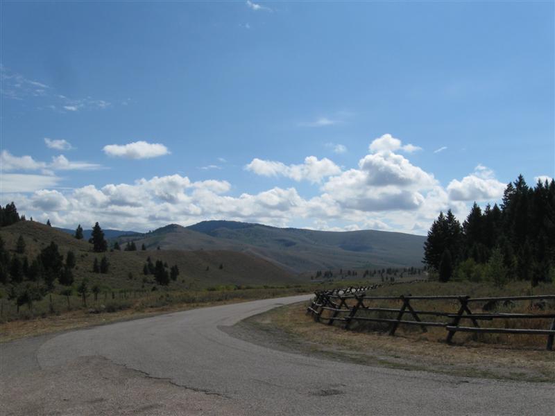
Very nice CG in a heavily wooded area. 24 sites (including 1 group and some doubles), split between 2 levels. Some sites paved and others gravel or dirt. Well developed sites, with parking, eating and tent areas nice and level and boxed in with wood. I'm on the "hilltop" level. Many sites very long for large rigs. Very handy to I15 with only very slight truck noise. Third time here. $10. |
|
|
8/19/14- |
Visiting my cousin in Dillon,
MT.
|
MT Back Country
#1 |
Sure had a great visit with my cousin and his wife. Always do. Only thing that would have made it better was to catch some fish. Worst fishing I've ever had there. My cousin didn't do much better, so the blame is not all on my fishing skills :) |
|
61 |
8/18/14 |
Divide Bridge CG (BLM). 2+ mi W of the jct of
MT43 and Interstate 15 (near Divide, MT), then about
1/4 mi S on CG dirt road. 5400
ft. |
25 gravel sites, on level land, in 2 separate sections. Main section is near the Big Hole River and has green grass between sites. Other section is further from the river and has no green grass. As common with BLM CGs, almost no shade in either section. Vault toilets. Launch ramp. Day use area with another launch ramp is 1/4 mi before you get to the CG. $10. |
|
|
60 |
8/17/14 |
Lodgepole CG (USFS). 12 mi SW of Wise River, MT on Wise
River Polaris Rd (aka Pioneer Mountains Scenic Byway). 6400
ft. |
10 paved sites, in a row, on level land. Between a not very busy hwy and the scenic, creek-like Wise River. Most sites are slighty sloped from front to back. All are only 50 feet, or so, from the creek. Most of the trees are between the back of the sites and the river (vs. between sites). Several other USFS CGs within a few miles. Vault toilets. $8. Caught 2 whopper trout in the creek with a flyrod; a 4 inch rainbow and a 7 inch brookie. |
|
|
59 |
8/15/14- |
East Bank CG (BLM) 8 mi W of Wise River, MT on hwy 43. 5700
ft. |
|
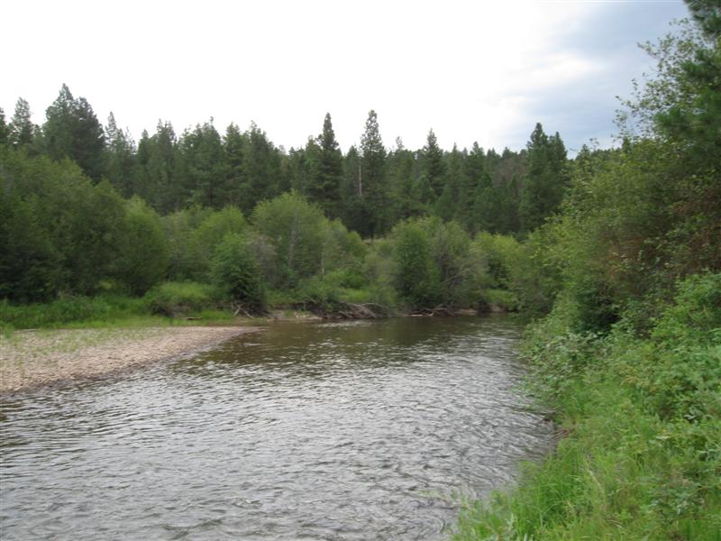
About 9 gravel sites on level land alongside the beautiful Big Hole River. Front of CG alongside a low traffic hwy. Back sites have less noise. Vault toilet. No trash svc. Boat launch ramp and day use area adjacent to CG. One of the most beautiful views you'll see in MT from there (see 2nd pic). Had rain for the 3rd night in a row. $0. Fished here many times. Fished 2 short sessions and caught just one, but a nice one. A 14" rainbow on a dry fly. Talked to others who hadn't done very good here and nearby either. |
|
58 |
8/14/14 |
Cable Mountain CG (USFS). About 17 mi
W of Anaconda, MT on hwy 1, then 3 mi N on Southern
Cross and Echo Lake Loop Rd. 6600 ft. |
|
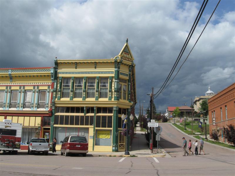
11 gravel sites on 2 levels. All sites in a nice grove of tall, skinny lodgepole pines for shade. Small creek at CG entrance. Vault and pit toilets. Water pump, but no trash svc. Only one other site occupied when I was there. $11. Rained quite a bit at night. After leaving, took a side trip to nearby Philipsburg. Rain interrupted my walking the streets of the historic district. Oh well, I did get my coffee and sweet roll. :) |
|
57 |
8/13/14 |
Hooper Park CG (City). In Lincoln, MT. 4600 ft. |
About 25 gravel sites on level land. In a grove of tall pines for good shade. Flush toilets. Some hwy noise, but speed is held down by in town limits. Nice Lewis & Clark related carvings in Park gazebo. Right in town so you can walk for a night on the town. Yeehaw! $10 (no hookups); $20 water & elec. This was the area where the infamous Unabomber had his cabin. More importantly, the Lewis and Clark Expedition passed near here on their return leg. |
|
|
56 |
8/12/14 |
Monture Creek CG (Montana State Fishing Access).
About 5 mi W of Ovando, MT on hwy 200. Watch for
campground sign to turn off hwy. 4000 ft. |
5 sites (some grass, some gravel) on level land. Two sites are by the hwy and the other 3 are about 1/4 mi from the hwy on a narrow dirt road. Much quieter at the back of the CG. No shade. Medium size creek alongside CG. Vault toilet. I was the only one there. $12 (or $7 w/MT fishing license). Creek had some nice water that looked there would be fish, but I didn't have any luck w/my fly rod. Obviously this doesn't mean there weren't fish. :) |
|
|
55 |
8/10/14- |
Harpers Lake CG (Montana State Fishing Access). 13
mi S of Seeley Lake, MT on hwy 83, then 3/4 mi W on
dirt CG road. 3900 ft. |
|
14 dirt/gravel sites, well apart, on level land. Plenty of shade in most sites from tall pines. Two small lakes (Harper and Blanchard) within walking distance. Vault toilet. No water. Nice and quiet. Only a slight hum from 2 hwys about a mile away. $12 (or $7 w/MT fishing license). Stayed a 2nd night because it was hot and my site had plenty of shade. Still was 9 p.m. before the inside of my camper was below 80F. |
|
54 |
8/9/14 |
Boondocking site (State?). Not a developed campground. 6+
mi S of Seeley Lake, MT on hwy 83, then 1-1/2 mi W on
dirt Placid Lake Rd. 4100 ft. |
Was on the way to check out Placid Lake and noticed some boondockers. I stayed across the road from them. Small Owl Creek alongside. Plenty of trees for shade. Downside is that there was a lot of weekend traffic on the dirt road by me during the day. Quiet a night, though. $0. The next day I backtracked to Seeley Lake and sat in the shade by the shore and read for a while. Lots of people enjoying the water. |
|
|
53 |
8/8/14 |
Boondocking site (USFS) Not a developed campground. 5
mi NW of Seeley Lake, MT on hwy 83, then about 1 mi
SW on Boy Scout Rd, then 1 mi NW on Deer Creek Rd. Watch
for WestsideTrailhead sign on Boy Scout Rd. 4100 ft. |
In a gravel, snowmobile parking lot used as a trailhead. Not particularly scenic, but nice and quiet. Vault toilet across road. I'd stopped at 4 USFS CGs on the way down and all were full. At the last one, the CG host told me about this place. Only a couple of miles off the hwy. I was the only one here. Glad I came. $0. |
|
|
52 |
8/7/14 |
Boondocking site (USFS) Not a developed campground. 20
mi N of Columbia Falls, MT on North Fork Rd (over half way gravel). Very
heavy washboarding on some parts of the gravel road. Turn
right just past Big Creek CG and the bridge. Very
narrow and steep "road" down to site. 3200 ft. |
|
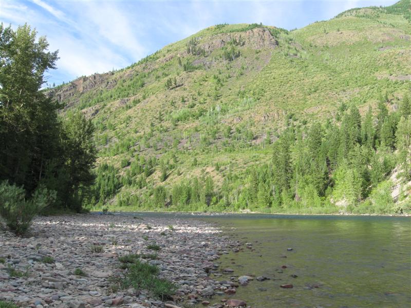
Located at the junction of the N Fk Flathead River and Big Creek. There ended up being 3 tenters along with me. Pretty much filled the space. I had the best spot with creek just behind me. $0 Wanted a spot in Big Creek CG, but it was full. CG host told me about this spot nearby. After making the drive down the narrow, steep road to it, I worried all the time I was there about getting out. Turned out OK, but I don't think I'd go there again. Heard a cracking sound on the way up. Caught a dead limb between my cab roof and camper overhang. (see pic). |
|
51 |
8/6/14 |
Upper Stillwater Lake CG (USFS). 22+ mi NW
of Whitefish, MT on US93, then about 2.5 mi S on various
dirt roads. Watch for CG signs at intersections.
3200 ft |
Small, but nice, 4 gravel site CG on a hillside. Pretty little lake in view of 3 of the sites. Very active train track on the other side of the lake. Otherwise, very peaceful. Nice modern bench overlooking the lake. Launch ramp. Vault toilet. $0. Would have stayed another night, but wanted to get to my next CG on Thursday, for a better chance at getting a site than Friday. |
|
|
|
|
Really enjoyed my time in BC, Canada. Especially the Kootenay Rockies (Western slope of the Rockies and the adjacent valley). |
|
|
|
50 |
8/5/14 |
Ponderosa CG, Kikomun Creek Provincial Park, BC, Canada.
About 12 mi S of Jaffray, BC on Jaffray-Baynes
Lake Rd (and others). 2600 ft |
|
36 gravel sites on level land. Unusual site
spacing. About 1/2 crammed together, like boat slips.
The lakefront ones have better than average spacing,
while the rest are fairly close together (but not crammed).
Never seen this before in a CG. No shade
in most sites, except late afternoon in the lake front
ones. On the long, but narrow, Lake Koocanusa.
Solar heated water for showers. Flush and vault
toilets. $5 dump station near park entrance. Two
other CGs in park. $30
(I'm guessing the lakefront ones are more). Origin of name of lake. KOOtenay River forms it; upper part is in CANada; lower in USA. Get it? :) Back to 90F+ weather. :( |
|
49 |
8/4/14 |
Dry Gulch Provincial Park CG, BC, Canada. 3 mi S of Radium Hot Springs,
BC off hwy 93. 3000 ft. |
|
26 gravel sites on a hillside. CG far enough off hwy that noise is only a hum. Enough trees that you can find a site with near full shade if you want. Flush and pit toilets. Was here in 2007. $21. After I left my previous campsite, I visited the nearby Takakkaw Falls. It has a free fall of 254 meters (833 ft.), and is the third highest in Canada. Very impressive sight! |
|
48 |
8/1/14- |
Monarch CG in Yoho National Park, BC, Canada. 37+
mi E of Golden, BC on Hwy 1. 4100 ft. |
|
44 gravel sites on level land, somewhat close together. About 4 are walk-in. Moderate amount of trees, so sites will get sun and shade during day. Between very busy TransCanada Hwy 1 and an almost vertical face of rock. Busy Canadian Pacific train track other side of hwy. Result: Constant sounds from one or the other. Not too bad at the back of the campground, where I am. This is offset by the view of spectacular mountains across the hwy. Wow! Larger CG (Kicking Horse) nearby. Vault toilets. $18 (plus required $8/day park pass). It was a 3 day weekend, so I elected to stay put in the same campsite. Got in about 3 p.m. on Friday and got one of the few remaining open sites. Took an afternoon trip to Lake Louise (only 15 mi E) on Sunday. Tried to see the lake, but only spent time in a very long line of cars going there. Turned around in the parking lot and came back w/o seeing the lake. Oh well, saw it in 2007. I'll look at my pics from then. :) |
|
47 |
7/31/14 |
Loop Brook CG in Glacier National Park, BC, Canada.
4 mi W of the Rogers Pass Visitor Center on Hwy
1. 3800 ft. |
|
20 dirt/gravel sites in 3 loops, on slightly sloping land. Plenty of trees. Fast stream alongside one side of CG, but no sites I saw were beside it. Flush toilets in nice wooden building. Similar nice shelter structure, with picnic tables. Some hwy and train sounds. Super view of mountains/glacier/stream from wooden bridge at the end of the road. Don't miss it! $22 (plus required $8/day park pass). You pay for the campsite at the campground, but then have to drive to the Visitor Center to buy the park pass. ???? While there saw a very interesting video on avalance control. |
|
46 |
7/30/14 |
Lamplighter CG, Revelstoke, BC, Canada.
In Revelstoke on Nixon Rd. 1500 ft. |
|
About 50 grass sites on level land. Sites close together, as typical in this type of CG. Shade varies with site, but some have quite a bit. Good facilities: Flush toilets/showers/laundry/camp kitchen/free WiFi. Close to center of town w/bus stop across the street. Better than the typical commercial CG, IMO. Would have enjoyed it more if the peak temperature wasn't around 90+F and my camper interior was still at 90F at 7 p.m. (w/fan on). :( $29. |
|
45 |
7/28/14- |
Echo Lake Resort. From Lumby, BC, Canada, go
1 mi E on Hwy 6, then R on Creighton Valley Rd for 13+
mi (mostly dirt, but good surface). 2700 ft. |
Small, secluded resort on a scenic, narrow lake. About 35 dirt sites close together. Some above the lake, some on the lakeshore (where I was). Also a few cabins with a nice lake view. Some putt-putt type fishing boats, but no speedboats. Lots of kids in the water. Got over 90F the 2nd day. Too hot for me. $27. This isn't the usual type of CG I would pick, but a BCer at a prior CG recommended it. I enjoyed it. Thanks, Dean. :) |
|
|
44 |
7/27/14 |
Allison Lake Provincial Park CG, BC, Canada.. 18
mi N of Princeton on Hwy 5A. 2900 ft. |
24 gravel sites, well apart, on sloping land. Some leveling of RVs probably required. Moderately busy Hwy 5A alongside CG. Medium height trees for some shade. Directly on the other side of the hwy is a nice lake, with a day use area. You can walk to it from the CG. $16. |
|
|
43 |
7/25/14- |
Mule Deer CG in Manning Provincial Park, BC, Canada.
47 mi E of Hope on Hwy 3. 3600 ft. |
49 gravel sites, well apart, on level land. Between busy Hwy 3 and the Similkameen River. About 1/3 of the sites are on the river. Medium height trees for some shade in most sites. Very busy hwy in the daytime, so plenty of noise, especially for sites right by the hwy. I'm near the hwy, but right by the river, so the river music masks out the hwy sounds some. Low of 38F at night. $21. I lucked out and drove by my site just as the previous occupants were leaving. Sure love those riverside sites! :) Since it was the weekend, I stayed 2 nights vs. my usual 1. |
|
|
42 |
7/24/14 |
Coquihalla CG (Muni) in Hope,BC,Canada. 200 ft. |
|
110+ dirt/gravel sites on mostly level land. Heavily wooded, so most sites have lots of shade and good privacy. Coquihalla River alongside, but you can only see it from a few tent sites that are on a dike. Flush toilets and showers. Laundry room at office bldg. Convenient to town for shopping. Was here in 2007. $35. |
|
41 |
7/23/14 |
Raser State Park. 17 mi E of Sedro Wooley,
WA on hwy 20, then 2 mi S and W on Russell and Cape
Horn Rd. . 150 ft, |
[no site pic - rainy] |
Nice CG with 38 paved sites on level land in 2 loops. Also 10 walk-in tent sites in a separate area. Plenty of shade. The large Skagit river is a short hike away. $24 Rained most of the time I was here. Glad my camper doesn't leak. :) |
|
40 |
7/21/14- |
Clear Creek CG (USFS). 3 mi S of Darrington, WA on Mountain
Loop Hwy. 600 ft. |
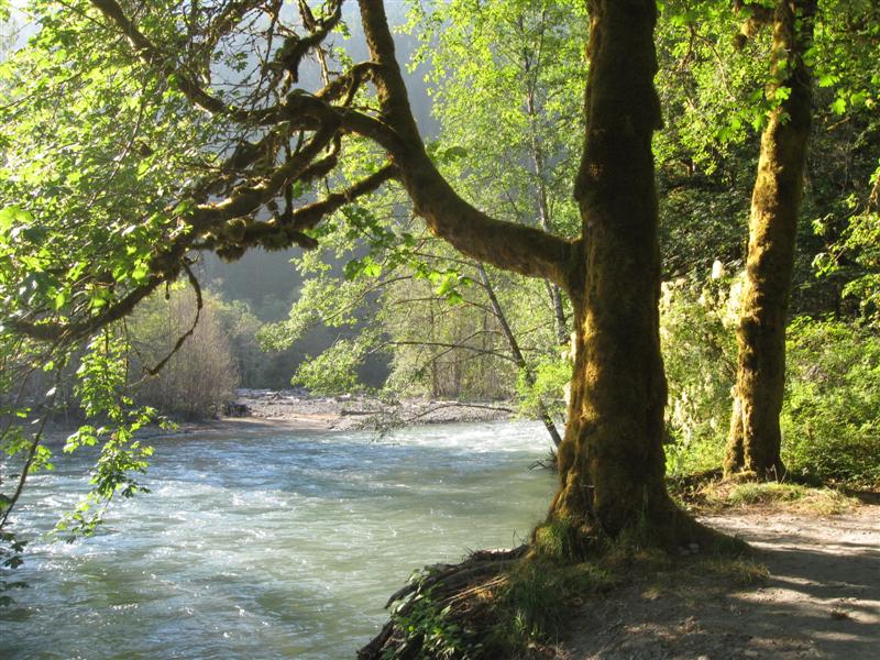
Nice little CG with 13 gravel sites on level land. Good site privacy. Between a low traffic hwy and the good sized Sauk River. River only visible from a couple of sites, but you can hear its music from all. Good view of it at the end of the CG road. Plenty of tall trees. No piped water. $14. Was a bit worn out from the bluegrass festival, so decided to spend 2 nights here to recuperate. :) |
|
|
39 |
7/17/14- |
Darrington Bluegrass
Festival, 3 mi W of Darrington, WA on hwy 530. 500 ft. |
|
Nice mid-sized festival with great music and scenery Be
hard to find a nicer facility for a festival. The
day I arrived and the day I left the weather was beautiful.
Mostly cloudy, otherwise, with misty rain on and
off (mostly off). I still listened to almost all
of the bands. My 3rd time here. Small world story: RVers near me were from CA and knew a good bluegrass friend of mine. |
|
38 |
7/16/14 |
Oak Harbor City Beach Park CG (aka Sailaway).
In the town of Oak Harbor, WA, near the harbor
at the end of Beeksma Dr. 50 ft. . |
|
56 gravel RV sites with full hookups in two areas.
Most sites are reservable. No shade in the
area I was in, but a bit in the other. Also
about 20 grass sites w/o hookups, best for tents. However,
host said I could park my truck camper there (which
I didn't). Maybe a 100 yard walk to the beach,
across a large grass area, also used by the general
public. Public access (includes campers) toilets
and showers are in this grass area, too. Very
close to major stores (grocery, WalMart, etc.). You'll
hear the sound of Navy jets frequently from a nearby
air station. A good deal with full hookups at
$25. |
|
37 |
7/15/14 |
Fort Townsend State Park. 4 mi S of Fort Townsend, WA
via hwy 20, then 1+ mi E on park road. 150 ft. |
|
40 sites total. About 12 sites in the lower "RV section", where I am. Grass sites right next together, with no significant privacy. Not very appealing. Other sites are on a hill in the woods and best for tents. However, I could have fit in some. Short walk to the water and a nice view across the bay to Port Townsend. Was here in '09. $24. Tried the Fort Worden State Park CG in Port Townsend first, but all filled. I really enjoyed the town of Port Townsend. Great place to watch harbor traffic. Took the ferry from Port Townsend to Whidbey Island to get to my next stop. |
|
36 |
7/14/14 |
Heart O' the Hills CG (Olympic National Park). 7 mi S of
Port Angeles, WA on Hurricane Ridge Rd. 1800 ft. |
100+ paved sites in five loops on hilly land. Many sites short and/or unlevel. A few larger pull-thru sites. Plenty of tall trees. The Hurricane Ridge Visitor Center is about 12 mi farther up the road, but I didn't go. $12. Was here in 2009 in the same exact site (because it's level and my GPS led me back)! |
|
|
35 |
7/13/14 |
Altair CG (Olympic National Park). From Port
Angeles, WA take US101 W for 8+ mi, then turn S on Olympic
Hot Springs Rd. CG is 4+ mi on the right (just
after crossing river).. 400 ft. |
31 paved sites, some tent only, on level ground. Alongside the fast flowing Elwha River. A few sites right beside the river, but all others still close (within 75 yards, or so). Sites further from the river have the most shade. Less site privacy than the last 2 CGs (due to closer together and less bushes). $12. Left last CG this a.m. and the temperature was around 60F. It hit a high of 92F on my way here and was about 80F at this CG. |
|
|
34 |
7/11/14- |
Mora CG (Olympic National Park). From Forks,
WA go N on US101 for about 1-1/2 mi, then W on La Push
Rd for about 8 mi, then turn N on Mora Rd. Sign
for CG is about 4 mi on the left. 100 ft. |
|
About 90 paved (IIRC) sites on level land in 5 loops. Very tall trees and dense vegetation result in very little sunlight in most sites. Mine had small spots now and then. Had to move my chair a lot to catch them. On the cool side; around 60F daytime. CG full (or close to it) Friday and Sat night. $12. When I left, I drove the couple of miles to Rialto Beach to see what it was like. Windy, foggy and cold with big piles of driftwood all around. I managed to knock myself in the noggin on one. :) Quillayute River flows into the ocean here, also. Worth the drive. |
|
33 |
7/9/14- |
Hoh Rain Forest CG (Olympic National Park). 13
mi SE of Forks, WA on US101, then 18 mi E on paved
Upper
Hoh Rd. 600 ft. |
|
Nice CG with 88 paved sites, well apart, in 3 loops. Pick your loop according to how much shade you want (much to partial). Loop A is near the milky, glacier fed, Hoh River. CG is walking distance to the small Vistor Center, where 2 trails (3/4 and 1-1/4 mi) start into the rain forest. Took them both and really enjoyed them. Even a walk around the CG is a good intro to what you'll see on the nature trails. A deal at $12. I really enjoyed it here: Had a nice site; perfect weather; interesting short hikes. |
|
32 |
7/8/14 |
Willaby CG (USFS). About 41 mi N of Aberdeen,
WA on US101, then 1+ mi E on South Shore Rd. 100 ft. |
|
22 paved sites in one loop, on the side of a hill. Several sites are best for tent, where parking is on the side of the road. Back-in sites are small rig sized (20' to 24'). Pretty Lake Quinault on one side of CG, where boats or fishing require Indian Tribe permit. Road on other side with minimal traffic. Rain forest type trees & plants here. $25. |
|
31 |
7/7/14 |
Grayland Beach State Park. W on Cranberry Beach
Rd, just S of Grayland, WA. 100 ft. |
100+ paved sites on level land. Site privacy usually good, due to bushes. About 50 sites parallel to the beach and the others in 5 small loops not far away. Very long beach and hardly any people there when I was (even though the CG was full). Saw a couple of vehicles on the beach. $37 (full hookups). A bit pricey for my taste. Guess I should be glad I got a site, though. Only 3 left w/o reservation when I arrived. |
|
|
30 |
7/6/14 |
Bruceport Park CG (County). 7 mi W of South Bend, WA off US101.
100 ft. |
40+ sites in a nice setting with lots of green stuff and overlooking scenic Willipa Bay (oyster capital of the world, I heard). Most sites on a level area, but a few are down in a hilly, low area. 7 full hookup sites, very close together, in level section. Slight noise from US101, but not bad. Flush toilets and showers. Was here in '07 and it's still $15. |
|
|
29 |
7/3/14- |
Hebo Lake CG (USFS). About 5 mi E from Hebo,
OR on Hebo Mtn Rd (paved & curvy). 1700 ft. |
|
12 gravel sites around a small lake. Some sites tent only and others best for small RVs. Loaded with tall, moss covered trees and greenery. People were pulling small trout (6" to 10") out of the lake right and left. Lake has 4 or 5 fishing docks around it. Trail from here to another lake about 5 miles away. No water. Got to put another few notches on the handle of my electric mosquito zapper. :) $12. Glad I decided to try and find a better spot for the holiday wknd. I grabbed the last available site when I arrived on Thursday. Nice and private and surrounded by bushes. Only downside is that the closest site to me had some rowdy, at times, people in it. Oh well, still glad I came here. |
|
28 |
7/2/14 |
Tillicum Beach CG (USFS). 4 mi S of Waldport,
OR on W side of US101. 100 ft. |
|
7Nice CG with 60 paved sites on level land, between US101 and a beautiful beach. Sites along US101 have a pseudo-surf sound from passing traffic, while the bluff sites, above the beach, have the real surf sound. Most bluff sites have parking parallel to the road and a grassy area for the table and a tent. Great views! Flush toilets. $24. Had a site I could have stayed in for the holiday weekend. However, it was next to noisy US101. I decided to take my chances for a better one up the coast. Risky move? |
|
27 |
7/1/14 |
Sutton Creek CG (USFS). From Florence, OR take
US101 N about 5 mi and turn W on Sutton Rd. CG is about 1/2 mi.
100 ft. |
Very nice CG with 80+ paved sites on level land, in 4 loops. Around 20 have electric. Good site privacy due to spacing and bushes between sites. A site is more likely to have lots of shade, vs. lots of sun, due to plenty of "Oregon greenery". Flush toilets. Small creek inside CG. A trail leads to some Darlingtonia carnivorous plants!! Didn't take it. $22. |
|
|
26 |
6/30/14 |
Bullards Beach State Park CG. From Bandon, OR
take US101 N for about 2+ mi and turn W on the
State Park Rd. CG is about 1/2 mi. 100 ft. |
|
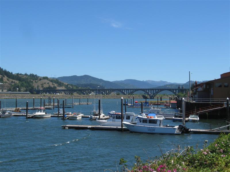
Very nice CG with about 180 paved sites (over 1/2 full hookup and the rest water & elec). Decent site spacing for a state park. Where I was in C loop didn't have much site privacy, but I walked around and many other sites had lots of bushes between sites. Plenty of trees. Flush toilets, showers and a free dump station. $26 (w/water & elec). After I left, I drove the road towards the beach and visited the Coquille River lighhouse. Even climbed up into the tower! On the way here, I drove out to Cape Blanco to look at the lighthouse and be able to claim I was on the westernmost point of land in the lower 48. Here's my GPS location to prove it! :) |
|
25 |
6/29/14 |
Huntley Park CG (County). 7 mi E of Gold Beach,
OR on Jerry's Flat (aka South Bank) Rd. 50 ft. |
|
70 grass sites on level land, alongside the wide Rogue River. Some sites tent only Shade varies from heavy "grove of trees" type to nil. The river view sites (where I am) have the least. You must cross a gravel bar of about 100 yards to get to the water. Flush toilets and showers. Nice and quiet here at night. $12. Pulled into a State Park near Brookings just as the "full" sign went up. This place worked out fine, though, and saved me $16. |
|
24 |
6/27/14- |
Panther Flat CG (USFS). From US101 just N of
Crescent City, CA take US199 E for 17 mi. 700 ft. |
|
Very nice CG wiith 39 paved sites on level land. Plenty of shade from a dense grove of a variety of very tall trees. Very good site privacy, due to spacing and bushes. Flush toilets and showers. However, due to water shortage use of temporary porta-potties is encouraged. The beautiful Smith River is a short walk down the hill, where there is a picnic area. Some noise from highway alongside. $15. Was a wet drive leaving last CG on Friday, but the sun finally came back out on Saturday afternoon. Yay! |
|
23 |
6/26/14 |
Big Lagoon Park CG (County). 7+ mi N of Trinidad,
CA on US101, then W on Big Lagoon Park Rd for about
3 mi (follow signs). 50 ft. |
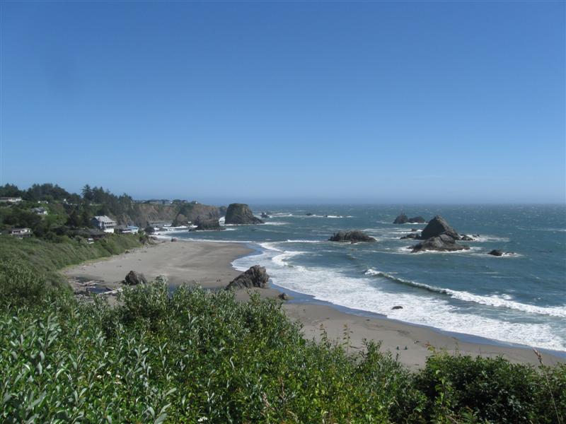
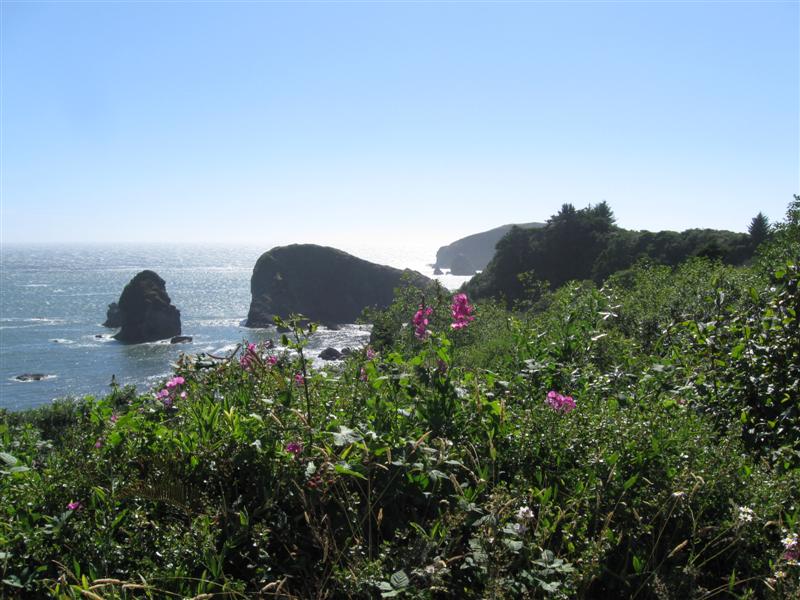
25 dirt/gravel sites (some tent only) on level land in a dense grove of tall, tall trees. Next to a (you guessed it) big lagoon with a nice beach. Flush toilets and showers. Day use area nearby. $20. |
|
|
22 |
6/25/14 |
Boise Creek (USFS). About 2 mi W of Willow
Creek, CA on hwy 299. 900 ft. |
Nice, compact CG with 17 dirt/gravel sites on level land in a single loop. In a dense grove of varied trees for much shade. My solar panel wasn't of use here. Some sites tent only and others best for small rigs. Busy hwy alongside, but mostly daytime noise. Steep trail down to a creek. $10. Had a nice chat with the friendly and informative CG host, Ranger Don. Very scenic (and curvy) drive to get here on hwy 299 from Weaverville. The beautiful Trinity River is alongside much of the way. It rained lightly much of the day. Been so long since I've seen it here in CA, that I didn't realize what it was, at first. :) |
|
|
21 |
6/24/14 |
Ackerman CG (USFS). 8 mi N of Lewiston, CA on
Trinity Dam Road. 2000 ft. |
56 dirt sites on level land, between hwy and skinny Lewiston Lake. Minimal to nil shade at most sites. Hwy noise not a problem when I was there, but the weekend might be different. Fee dump station. $9 camping fee (winter rate due to non-potable water problem; usually $18). After I left, I visited the museum in nearby Weaverville. Interesting place. |
|
|
20 |
6/23/14 |
Hat Creek CG (USFS). 12 mi N of Lassen National
Park N Entrance on hwy 89/44. 4400 ft. |
60+ paved sites on level land. Minimal shade in several sites. Alongside the beautiful, super clear Hat Creek. Three other close by USFS CGs are also alongside the creek, but noisy from being close to the hwy. Here you can get further away from the hwy for minimal noise. 3rd time here. $6 dump station at USFS center nearby. $16. Tried fly fishing the creek for about 1/2 hour. Not even a hit. Got to wet a line to have a chance, though. :) |
|
|
19 |
6/22/14 |
Bogard CG (USFS). From Susanville, CA 6 mi
E on hwy 36, then about 21 mi NW on hwy 44 (aka Feather
Lake Rd), then 1.5 mi W on dirt (and bumpy) Fgs Cutoff
Rd, then 1/2 mi N on marked campground rd. 5700
ft. Note: My GPS didn't route me via Fgs Cutoff Rd. Tried to make me take a non-existent road further N. |
Nice, small CG with 13 paved sites around a paved loop. At least partial shade for all sites from many pine and aspen trees. Very quiet. The only sounds of civilization I heard was a train about 2 mi away. Old style pit toilet (but it didn't stink). Pumped water, but no trash service. The price is right at $0 and I was the only one here!. Very scenic drive up hwy 44. I passed two big meadows that had signs saying they were actually reservoirs. A definite indication of lack of rain this past winter in CA. :( |
|
|
18 |
6/20/14- |
Lassen County Fairgrounds in Susanville, CA. 4000
ft. |
Here for the 2nd time for the very fun Susanville Bluegrass Festival. Medium size festival with mainly local/regional acts, but plenty of very good music! Weather was great. Headliner was the only nationally touring act, Bluegrass Etc. Seen them several times. Super pickers and funny, too. I also really liked a band of young 'uns from the Seattle area, North Country. Hot pickers! |
|
|
17 |
6/19/14 |
Sycamore Grove CG (USFS). 2.5 mi S of Red Bluff,
CA on Sale Lane. 250 ft. |
|
Very pleasant CG with 30 paved sites on level land, in a single loop. Plenty of shade from a large grove of primarily leafy type trees. The wide Sacramento River is a very short walk, but not visible from the CG. Several hiking trails nearby. Flush toilets and showers in one of the 2 restrooms. Has the feeling of a County CG vs. a typical USFS one Very convenient for I5 travelers. $16 |
|
16 |
6/10/14 |
Sand Flat CG (USFS). 29 mi E of Placerville,
CA on US50. 3900 ft. |
|
23 paved sites on level land, usually close together. A mix of needle and leaf type trees. Between a busy hwy and the fast flowing (in spots) and boulder strewn S Fk American River. If you have a riverside site (like me). river music usually overrides hwy noise. $18. |
|
15 |
6/4/14- |
Robinson Creek CG (USFS). 9 mi SW of Bridgeport, CA on
Twin Lakes Rd. 7000 ft. |
|
Very popular CG with 54 paved sites in tall pines on level land. Shade varies significantly with site. The very nice Robinson Creek wraps around the CG. Usually good fishing, if they have stocked recently. Many sites on the creek. My favorite Sierra CG. Several other CGs nearby. $20. Had a great time camping with my son and family. Helped my 4-1/2 yr old granddaughter catch her first 2 fish (I hooked them and she reeled them in). :) This was my 38th year to camp in this area. For the first time, I saw a bear in the campground during daylight. Also saw a momma and 2 cubs lounging in a tree at a commercial campground nearby. |
|
14 |
6/3/14 |
Sagehen Meadow CG (USFS). From Lee Vining, CA go 5+ mi
S on US395, then 15+ mi E on hwy 120, then 2 mi
S on good dirt road (watch for CG signs). 8300
ft. |
|
Called a CG, but really a camping "area". No tables or fire rings, except 2 camper-built stone rings. One ancient pit toilet. Two relatively flat cleared areas among pines and aspens. Land quickly rises to the W. Very peaceful here with only the sounds of nature and an occasional jet. Would be utopia with a fishing stream loaded with fish. :) Low of 30F. $0 Had it all to myself and would have stayed a 2nd night, but had CG reservations near Bridgeport. |
|
13 |
6/1/14- |
Boondocking site (USFS) Not a developed campground. 7+ mi
S of the June Lake junction on US395, then about 1/2
mi E on Owens River Rd, then dirt roat to left. 7500
ft. |
Very nice boondocking spot, with plenty of room, and a lot of tall pines. Not in the "boonies", however, as US395 is only 1/2 mile away. However, minimal noise from trucks and that is frequently masked out by "wind in the pines". Liked it so well that I decided to stay 2 nights. Got down to 26F second night!! $0 On the way here I visited the nearby Inyo Craters area (parking here). One crater has almost no trees and a small lake at the bottom. The 2nd is filled with large trees. Wonder why the difference? Didn't hike to the 3rd one. The last night I was here I woke up to a dog barking frantically and sometimes howling. Then 3 gunshots over a period of a few minutes. Later the barking stopped. There was another RVer a couple of hundred yards away from me. Wonder if his dog sensed a bear? |
|
|
12 |
5/31/14 |
Sherwin Creek CG (USFS). 37 mi NW of Bishop, CA on
US395, then 3+ mi W on Sherwin Creek Rd. (Note:
Alternate route from town of Mammoth Lakes going E on
Sherwin Creek Rd about 2 mi.) 7600
ft. |
Very nice CG with 85 dirt sites on varying terrain, in 3 loops. Plenty of shade from a heavy stand of tall pines. Vault toilets. Close to town for supplies. $22. Maybe 10 other sites occupied. I couldn't see anyone from mine. Yay! |
|
|
11 |
5/30/14 |
Convict Lake CG (USFS). 34 mi NW of Bishop,
CA on US395 then 2 mi SW on Convict Lake Rd. 7600
ft. |
|
85 paved sites on sloping land. Small Convict Creek alongside CG. Beautiful Convict Lake, surrounded by tall peaks, at CG entrance. Many sites full sun. Creekside sites have more shade. Caught 1 trout and lost one lure. $22 Walked down by the lake when I left. Looks almost full, vs. very low Sabrina a few days ago. Water is incredibly clear. Saw several people with good stringers of fish.. |
|
10 |
5/29/14 |
McGee Creek CG (USFS). 30+ mi NW of Bishop,
CA on US395, then 2 mi S on paved McGee Creek Rd
(less then 2 lanes in spots). 7500 ft. |
|
28 paved sites on level land with sand tent pads. No shade for RV/tent, but shade structures for all sites with picnic table and bear box. Nice views into the mountains and back towards the valley. Parts of CG ringed with aspen groves. Small, fast flowing creek alongside CG, with heavy tree/bush coverage on bank. Restroom bldg has flush toilets and sinks. $20. Only 2 others here. Low of 30F at nite. |
|
9 |
5/28/14 |
Bishop Park CG (USFS). 15 mi SW of Bishop,
CA on West Line St (aka CA168). 8400 ft. |
|
About 20 dirt sites on sloping land (several tent only). The fast flowing Bishop Creek (N Fk) is alongside most sites (and below some). Heavy shade at many of the tent sites. Not much at the RV sites. Flush toilets and bathroom sinks. Down to 31F at nite! $23. Same creek as last night, but faster here because there is more of a slope. Drove up to nearby South Lake. It's more like South Pond. Water is nowhere near the dam. See pics. |
|
8 |
5/27/14 |
Sabrina CG (USFS). 18 mi SW of Bishop,
CA on West Line St (aka CA168). 9000 ft. |
About 20 dirt sites on level land (some tent only). A mix of pines and aspens (leafs just coming out). All sites between the road and the small Bishop Creek (N Fk). The pitifully low Lake Sabrina is at the end of the road, 1 mi further up. $21. Been fishing this creek for 40+ years. Caught a couple in a short session. Creek very low, more like fall conditions. All because of very little snowfall this year and the lake feeding the stream is very low (see pics). It's sad to see the usually beautiful Lake Sabrina (one of my favorite views) so low. :( |
|
|
7 |
5/26/14 |
Sage Flat CG (USFS). 9 mi W of Big Pine, CA
on Glacier Lodge Road (aka Crocker in town). 7400
ft. |
|
28 paved sites on gently sloping land in 2 loops. Paved interior road. Piped water. Plenty of tall pines for shade at least part of the day in all sites. Beautiful, fast flowing small creek (Big Pine) along one side of CG. I got an A+ site with the creek just behind my camper! Nice "nature music" for sleeping. Two other CGs just up the road (Upper Sage Flat and Big Pine Creek). Also, Glacier Lodge, with food (didn't try it). Road ends at lodge. $21. Was getting too hot (90+) in the valley. Headed for higher elevation and it paid off! Boy, were there a lot of cars and RVs head S on US395 as I was headed N. Sure glad I'm not a "worker bee" anymore. :) |
|
6 |
5/25/14 |
Boondocking site (BLM). Not a developed campground. In
the Alabama Hills area a few miles W of Lone Pine, CA,
off Whitney Portal Rd. 4700 ft. |
|
Very interesting rock formations close by and the majestic Eastern Sierras in the distance. Mt. Whitney visible from my site. Absolute quiet at night. I stayed up late enough (yawn) that I saw a sky full of stars. Same exact spot I was in Memorial Day wknd 2012 (thanks to my GPS)!. $0. This area was the site of many, many movies, especially old cowboy ones. In the middle of the night I awoke to the sound of a galloping horse and the shout of "Hi Ho Silver". Could it have been the ghost of ...... naw. :) Visted the very interesting Museum of Lone Pine Film History. Highly recommended! |
|
5 |
5/22/14- |
Tuttle Creek CG (BLM). 5 mi SW of Lone Pine,
CA via Whitney Portal Rd & Horseshoe Meadow Rd.
5100 ft. |
|
80+ dirt sites, well apart, on sloping ground. Zippo significant shade. Vault toilets. Beautiful view of the Eastern Sierra mountains and the Owens Valley. Very small creek in CG, but stocked with trout. Saw one lady with about a 14 incher. Just several miles away from the highest point in the lower 48 - Mt. Whitney, 14,494 ft. $5 dump station and $5/nite. Got here Thursday afternoon to stake out my spot for the holiday weekend. A few spots still available when I took a walk around the CG Friday a.m. Very windy, but seems to be slacking off on Friday afternoon. Snowed in the mountains a day or so ago. Third time here. |
|
4 |
5/21/14 |
Fossil Falls CG (BLM). 40 mi S of Lone Pine,
CA on US395, then E on dirt Cinder Road for 1 mi. |
|
11 dirt sites, well apart, in a desert enviroment. Plenty of black lava rocks around. No shade. Vault toilet and pumped water. Far enough from hwy for minimal noise. Fossil Falls (dry) viewing about a 1/2 mile walk. Very interesting rocks there. Large cinder cone nearby (can't miss it). $6. |
|
3 |
5/20/14 |
Ricardo CG, Red Rock Canyon State Park. 25 mi north of
Mojave, CA off CA14. 2600 ft. |
50 dirt/sand sites. Desert environment. Interesting rock formations here. Off highway far enough to be very peaceful. A bit windy, but didn't get blown over. Third time here. $25. A movie was being filmed here with Kevin Bacon. The parking lot was full of cars and trailers. No scenes were shot while I was here, however. Interestingly, a few years back I passed through the town of Ennis, FoMT and watched a scene being shot on the main street. Who was in it? Kevin Bacon! Deju Vu all over again. :) |
|
|
2 |
5/7/14 |
Doheny State Beach, Dana Point, CA. 40 ft.
|
|
My usual campground when visiting Orange County. 100+ sites. Very popular. Complete with the sounds of surf and passing trains. Some campsites right on the sand (if you want to pay $60). I'm the next row back to save $25 (6+ gal of gas). $35 |
|
1 |
5/5/14 |
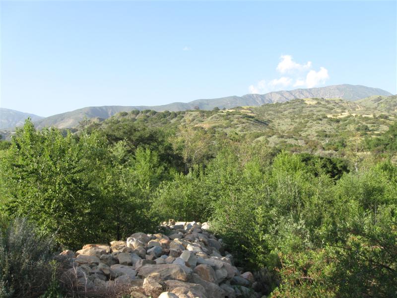
Steckel Park CG (County), 5 mi N of Santa Paula, CA on Ojai Rd.
700 ft. |
|
My frequent stop to and from SoCal. 40+ sites between the hwy and a large river bed. 8 or so with hookups and concrete pads. Quite a few large oak trees. Porta potties and one restroom with flush toilets and showers. I'm in the cheaper, no hookup section, with dirt sites. Santa Paula River a short walk. $22. |


|
[Home] [Camper Add-Ons] [Campsite Map] [Interviews] [Photo Albums] [Sporadic Blog] [Tips] [My Music] [Contact Me]
|